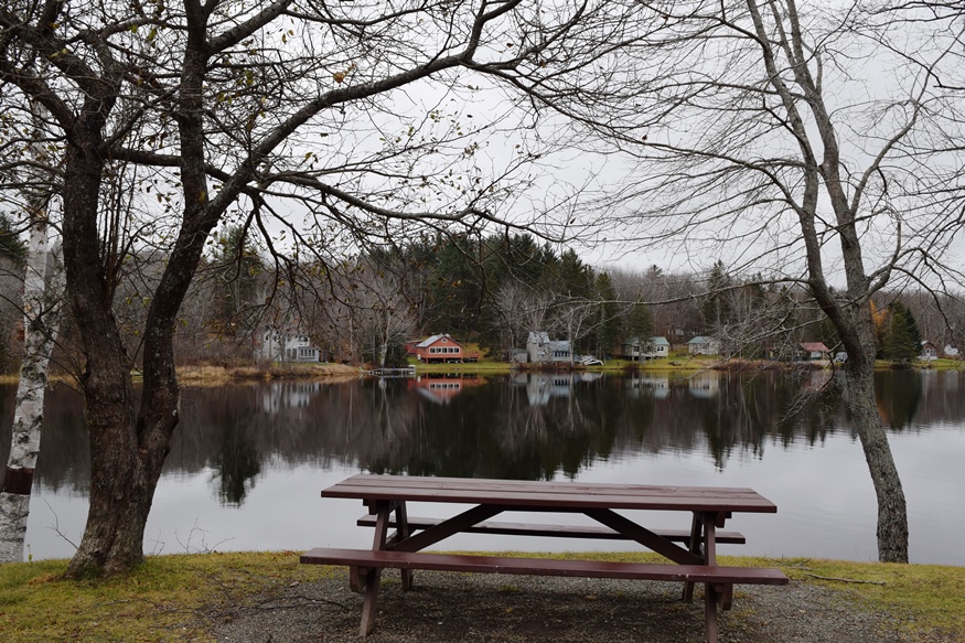
Picnic Area and Cottages at Kingsbury Pond (2018)

Location Map for Kingsbury
| Year | Population |
|---|---|
| 1970 | 7 |
| 1980 | 4 |
| 1990 | 13 |
| 2000 | 9 |
| 2010 | 28 |
| Geographic Data | |
|---|---|
| N. Latitude | 45:09:00 |
| W. Longitude | 69:35:53 |
| Maine House | District 118 |
| Maine Senate | District 4 |
| Congress | District 2 |
| Area sq. mi. | (total) 44.6 |
| Area sq. mi. | (land) 44.1 |
| Population/sq.mi. | (land) 52.5 |
County: Piscataquis
Total=land+water; Land=land only |
|
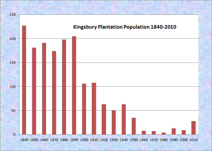
Population Trend 1840-2010

“Town Line Entering Kingsbury Plt.”on Route 16
[KINGS-buree] is a plantation in Piscataquis County, incorporated as a town on March 22, 1836 from the township T3 R2 BKP, EKR (Bingham’s Kennebec Purchase East of the Kennebec River).
In 1833, the township had been purchased by Sanford Kingsbury of Gardiner, thus the name. Two brothers by the name of Hilton settled here in 1834. By 1836 the township had grown enough to successfully incorporate as a town.
In the mid-1880’s, George Varney observed,
The trees usual in the region flourish here; and the primeval forest still stands to such an extent that one road passes through it for 9 miles without encountering a single opening. There is a saw-mill and grist-mill, built in 1835 by Judge Kinsbury . . . on the outlet of Kingsbury Pond. . . .
There are now a store, hotel, mechanic-shops, and the mills already mentioned in Kingsbury Village. There is a church organization of the persuasion called Buzzellites [followers of John Buzzell, who split from the Free Baptists in 1835].
")
Kingsbury Pond Rest Area (2007)
In 1886 it surrendered its organization but reorganized as a plantation the following year. That second organization was made valid by an act of the Legislature in 1895.
 N45° 7' 0.88\" W69° 38' 57.63\"")
Kingsbury Pond (2007) @
")
Kingsbury Pond (2007)
 N45° 7' 3.26\" W69° 38' 49.39\"")
Buildings, near the East end of the Pond (2014) @
 N45° 7' 3.65\" W69° 38' 48.68\"")
Dam at the East end of the Pond (2014)
The rest area and picnic grounds are at the Pond near the village. Swimmers use the dam for parking and access to the water. The main village is located on the eastern end of Kingsbury Pond along Maine Route 16, which continues east through Happy Corner to Abbot Village in the town of Abbot.
")
Dam at the East end of the Pond (2014)
Form of Government: Assessors-Annual Meeting.
Additional resources
Department of Commerce. U.S. Bureau of Census. Special Reports Religious Bodies: 1906, Part II, Separate Denominations: History, Description, and Statistics. Washington. Government Printing Office. 1910.
Varney, George J. A Gazetteer of the State of Maine. 1886. p. 303.
Will, Richard. “Phase 0 Precontact Period Archaeological Assessment: Bingham Wind Project: Bingham and Mayfield (Somerset County), Kingsbury, Parkman, and Abbot (Piscataquis County), Maine.” Submitted to Maine. Department of Environmental Protection. http://www.maine.gov/dep/ftp/WindPowerProjectFiles/BinghamWind/application/8_Arch_Historic.pdf (accessed November, 15, 2014)